Our Services

Precision aerial visuals and data tailored for your projects.
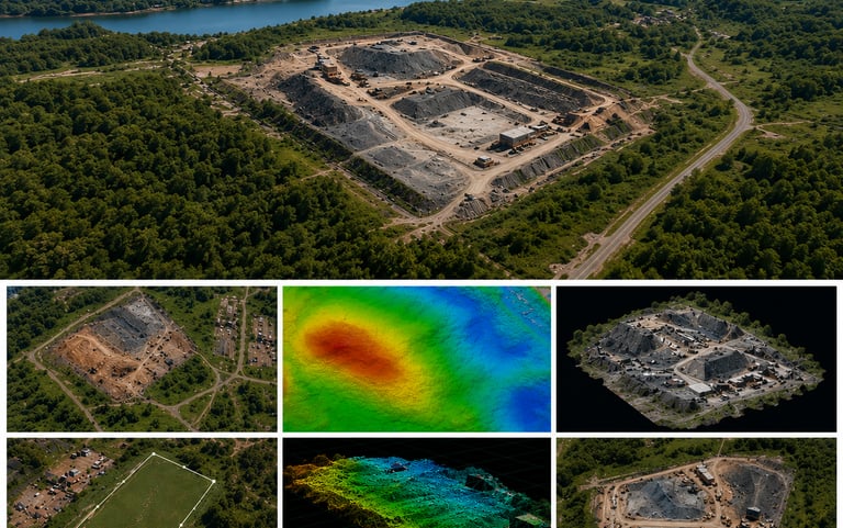
Photography

Capture stunning photos that highlight every detail and angle.

Detailed mapping and site documentation for informed decision-making.

Mapping
A drone pilot operating a drone with a scenic real estate property in the background.
Top-down drone image showing a construction site with clear boundaries and marked zones.
Project Documentation

Reliable site documentation through aerial videography, supporting commercial clients with clear, up-to-date records.

Real Estate

High-quality real estate photography that highlights properties with clarity, accuracy, and visual appeal.

Videography

Smooth, cinematic drone footage that brings your site to life.

Get in Touch

Reach out for drone services or digital resources.